|
| ||||||||||
| | |||||||||
THE GLEADLESS
VALLEY Although the nearby Arbourthorne estates were built in the 1930s, the Gleadless Valley continued to be farmed until the 1950s, retaining a rural landscape of hedge-lined fields, woodlands and scattered farms. Urban development of the valley began in the late 1950's and continued into the 1960's, with the valley's housing estates being built to accommodate approximately 17,000 people. This development was remarkable for the way in which a network of open spaces based around the valley's existing mature woodlands was retained, both within the development, and between it and neighbouring built up areas. Most of these open areas have remained to the present day. The
Meers Brook, the major watercourse in the Gleadless Valley, is of historical
importance as it once formed part of the boundary between the Anglo-Saxon
kingdoms of Mercia and Northumbria. The name of the river dates from this
time, 'Meer' being the Saxon word for boundary. The river continued to
form part of the county boundary between Yorkshire and Derbyshire until
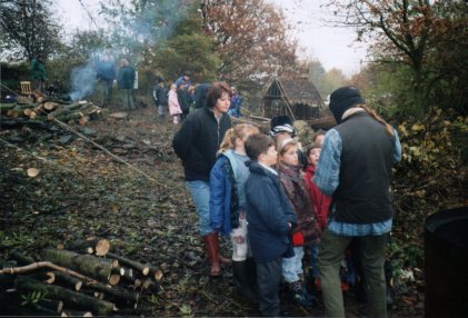
as late as 1933. ARCHAEOLOGY Boundary banks have been found on the south-eastern and western edges of Leeshall Wood and the first of these is thought to be medieval in age. These would probably have been made to keep animals and intruders out of the woodland whilst coppice wood, used in the production of charcoal and whitecoal, was growing. Areas of pits and depressions in Lees Hall Wood are thought to be the result of the digging of surface coal. The remains of trackways can also be found in parts of the wood. ANCIENT WOODLAND
STATUS The earliest known documentary evidence for woodlands in the Gleadless Valley dates from 1462 and refers to 'Herdyng Wood', the name given to the then more extensive area of woodland now split up to produce the two woodland areas of Herdings Wood and Rollestone Wood and The Lumb. The earliest written record for the Leeshall area dates from 1583 and refers to Carr Wood. The wood takes its name from Lees Hall, a now vanished farm known to have been established before 1616. 'Lees' is a Saxon word for a woodland clearing and reflects the way in which flatter land was converted to agriculture, with residual areas of woodland being left on steeper terrain. Although no documentary evidence exists for Lees Hall Wood, its shape, boundaries, archaeological features and terrain are similar to those of the known ancient woodlands in the valley and strongly suggest that this woodland is also ancient. Another way in which ancient woodlands can be distinguished from more recently established woodlands is by their diverse flora and fauna. Indeed, certain plant species, usually those that spread relatively slowly by vegetative means, are known to be either entirely restricted to, or only rarely found outside, ancient woodlands. These are known as 'ancient woodland indicator species'. Where a number of these species are found together, there is a high likelihood that the wood in which they occur is of ancient origin. A wide range of ancient woodland indicator species occur in woodlands in the Gleadless Valley, including Bluebell, Dog's Mercury, Ramsons, Wood Anemone, Wood Sorrel and Yellow Archangel. The rich flora of Lees Hall Wood includes many of these ancient woodland indicators. WOODLAND MANAGEMENT
Whitecoal,
a material somewhat similar to charcoal but used in lead smelting rather
than iron and steel production, is also known to have been produced in
Lees Hall Wood. Evidence for this comes from the the presence of characteristically
shaped whitecoal pits (also known as Q-pits because of their shape). There
is a well-defined example in the central part of the wood.
|