|
BOWDEN HOUSTEADS
WOOD - EDUCATIONAL USE
INTRODUCTION
Bowden Housteads Wood is well used as an education resource by both
primary and secondary schools.
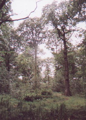
The northern
part of the site is generally the most suitable for educational
use, being the largest block of woodland and therefore the least
affected by noise from the main roads that separate the three parts
of the wood. The two southern sections of woodland do however provide
a useful resource for the consideration of the impact of development,
(in this case, new roads) on natural areas. In addition, open areas
adjacent to these two southern blocks of woodland form a useful
contrast to the woodlands themselves.
More detailed
information to support education work in the wood can be found in
the Fuelling a Revolution education pack covering Bowden Housteads
Wood. Details on how to obtain this can be found in the Schools
section of this website.
SUGGESTED
ACTIVITIES FROM THE SCHOOLS SECTION OF THIS WEBSITE
The Schools section of this
website provides units of work covering a wide range of subject
areas and Key Stages. Although, all or most of these units, would
be suitable for use in Bowden Housteads Wood, some are particularly
appropriate, and for this reason, direct links to these downloadable
materials are provided below.
Key Stage 1 Numeracy - 'Looking
at Leaves'
The variety of tree species in the wood makes it particularly suitable
for this unit with its focus on leaf shape and symmetry.
Key Stage 1 Science - 'Plants
and Animals'
The proximity of parts of the wood to areas of open ground makes
it ideal for this unit comparing the flora and fauna of wooded and
non-wooded areas.
Key Stage 1 Geography -
'Our
Local Wood'
Being situated close to residential areas, Bowden Housteads Wood
could be easily incorporated by nearby schools into a walk around
their local area, looking at different land uses.
Key
Stage 2 Literacy - 'Read
All About It'
Devise a leaflet telling users of the site about the woodland and
describing what they might see when following the trail
through the wood described elsewhere on this site.
Key Stage 2 Numeracy - 'Girth
& Gaps'
Use this unit to compare the dense growths of young trees found
in areas in which felling has taken place with those in areas of
more open woodland.
Key Stage 2 Science - 'What
Lives Where?'
The range of vegetation types on and adjacent to the site provides
a resource for studying where specified animals find shelter, water
and food.
Key Stage 2 Science-'Life
Cycles'
The range of ages of trees on the site makes it ideal for the study
of changes during a tree's life cycle, from seed through sapling
and mature tree to old age, death and decay.
Key Stage 2 Geography -
'Do
you come here often?'
Because of its location, Bowden Housteads Wood is a popular place
for both formal and informal recreational activities, some of which
are acceptable and others of which are less so. Its visitor base
has been widened by the Trans-Pennine Trail which runs through the
site. This unit could be used to study recreational activities taking
place and to consider potential conflicts between these and possible
effects on the site.
Key Stage 2 Art - 'Signposts'
The development of waymarking is one priority for Bowden Housteads
Wood under the Fuelling a Revolution programme. Children could use
this unit to develop their own designs for this.
 |
|
Glades
found throughout the wood could be compared to areas in which
felling has not taken place in the recent past.
|
Key Stage 3 Science - 'Are
all woods the same?'
This unit of work could be used to compare the fauna and flora of
different parts of the site. A wide variety of contrasting areas
are available for comparison, including:
- dense
woodland and recent clearings
- Oak and
Beech dominated areas
- dry areas
and streamsides
- the edges
and interior of the wood
- woodland
and adjacent open space
Key
Stage 3 Science - 'Tree
of Life'
The existence of woodland areas dominated by one species (e.g. Beech
or Oak) makes it a suitable resource for this unit considering one
tree species and its associated flora and fauna.
Key Stage 3 Geography -'Woodland
Climates'
The way in which Bowden Housteads Wood is divided into a number
of small blocks with adjacent areas of open ground makes it particularly
suitable for this unit, which could also look at the climatic effect
of recent woodland management work i.e. the creation of glades.
Key Stage 3 Geography - 'Woodlands
in the World'
The heavy public use of Bowden Housteads Wood and the way in which
it has been split into a number of separate areas by road construction
provides a valuable stimulus for the consideration of issues relating
to sustainability.
Key Stage 3
Art 2 - 'Fuelling a Revolution'
Being heavily used by the public, Bowden Housteads Wood could provide
a venue for the design of sculpture for a woodland site. An environmental
artwork is planned for the site as part of the Fuelling a Revolution
programme.
In addition, other useful resources from the Fuelling a Revolution
education packs and from 'get, set... Grow', the South Yorkshire
Forest schools' pack, can be downloaded from Downloadable
Pupil and Teacher Resources for Key Stage 2 in the Schools section
of this site.
The 'Tree File' CD ROM that accompanies the 'get, set... Grow'
pack contains identification details and background information
for all of the major tree and shrub species found in the wood including
Oak, Beech, Sweet Chestnut, Sycamore, Birch, Whitebeam, Wild Cherry,
Holly, Hawthorn, Hazel, Ash, Alder and Field Maple. For further
information, go to the section on printed
education materials in the Schools section of this website.
OTHER
ACTIVITIES
Key Stage 3 Geography
Tributary streams to the Car Brook in the northern part of the site
show clear evidence of the accelerated erosion caused by run-off
from the Sheffield Parkway and other roads.
  
|

