|
GIBBING
GREAVE & HERRINGTHORPE WOODS - EDUCATIONAL USE
INTRODUCTION
Gibbing Greave and Herringthorpe Woods both have considerable potential
for educational use, especially as they are easily accessible and
situated close to a populated area. Both woods are already well
used as an education resource by both primary and secondary schools.
More detailed information to support education work in the wood
can be found in the Fuelling a Revolution education pack covering
Gibbing Greave and Herringthorpe Woods. Details on how to obtain
this can be found in the Schools
section of this website.
SUGGESTED
ACTIVITIES FROM THE SCHOOLS SECTION OF THIS WEBSITE
The Schools section of this
website provides units of work covering a wide range of subject
areas and Key Stages. Although, all or most of these units, would
be suitable for use in Gibbing Greave and Herringthorpe Woods, some
are particularly appropriate, and for this reason, direct links
to these downloadable materials are provided below.
|
|
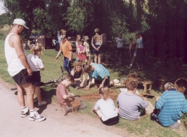
Basket
weaving at the Forest Fever Funday in Herringthorpe Valley
Park
|
Key Stage 1 Science - 'Plants
and Animals'
This unit could
be used to compare the wildlife of the two woodlands with either
your own school grounds or open areas of Herringthorpe Valley Park.
Key Stage 1 Geography- 'Our
Local Wood'
Being situated close to residential areas, the two woodlands could
form part of a route around the local area looking at different
land uses.
Key Stage 2 Literacy-'Read
All About It'
Devise a leaflet telling users of the site about the woodland and
describing what they might see when following the trail
through the wood.
Key Stage 2 Numeracy - 'Girth
& Gaps'
This unit could be used to compare the spacing and measurements
of trees in the semi-natural area of Gibbing Greave with that of
the plantation areas.
Key Stage 2 Science - 'What
Lives Where?'
The range of vegetation types on and adjacent to the site provides
a resource for studying where specified animals find shelter, water
and food.
Key Stage 2 Science-'Life
Cycles'
The range of ages of trees on the site makes it ideal for the study
of changes during a tree's life cycle, from seed through sapling
and mature tree to old age, death and decay.
Key Stage 2 Geography -
'Do
you come here often?'
The two woodlands are popular places for formal and informal recreation,
being used for a wide range of recreational activities, some of
which are acceptable and others of which are less so. This unit
could be used to study recreational activities taking place and
to consider potential conflicts between these and possible effects
on the site.
Key Stage 2 Art - 'Signposts'
The area
has for some years been the focus for an environmental arts initiative
which has involved the development of wood sculptures and carved
signs and stiles. Use these to provide a stimulus for the design
of signposts and waymarking and trail markers for the trail
Key Stage 3
Science - 'Are All Woods
the Same?'
This unit of work could be used to compare the fauna and flora of
the semi-natural and plantation areas of the site. The woodland
areas to the north and south of the stream in Gibbing Greave would
be particularly valuable for this.
Key Stage 3 Science - 'What
causes plants to change?'
The area of semi-natural woodland in the northern part of Gibbing
Greave has a substantial quantity of Holly in its shrub layer. Use
this unit to investigate changes in leaf shape and size at different
heights above the ground and under different lighting conditions.
Key Stage 3 Science - 'Tree
of Life'
The dominance of parts of both woodlands by single tree species
makes the site particularly suitable for this unit which looks at
the flora and fauna associated with one tree species.
Key Stage 3 Geography-'Woodland
Climates'
Use this unit to compare the climates of the Beech plantation areas
and semi-natural woodland area to the open area of Herringthorpe
Valley Park. The unit could also be used to examine the effect on
climate of altitude, slope, aspect and proximity to streams.
Key Stage 3
Art & Design - 'Recreating
Woodlands'
The Beech plantation area to the south of the stream in Gibbing
Greave, with its strong vertical tree trunks contrasting with fallen
horizontal trunks, together with the way in which defined areas
of light penetrate the canopy has considerable potential as a stimulus
for art work.
Also of potential
as a basis for artwork are the shapes of the standing deadwood in
the recently created glade close to the northern edge of Gibbing
Greave.
Key Stage 3
Art 2 - 'Fuelling a Revolution'
This unit which examines art in public spaces and uses the woodland
as a stimulus and setting for three-dimensional art and design work
could take as a starting point the environmental art work that already
exists at the site.
In addition, other useful resources from the Fuelling a Revolution
education packs and from 'get, set... Grow', the South Yorkshire
Forest schools' pack, can be downloaded from Downloadable
Pupil and Teacher Resources for Key Stage 2 in the Schools section
of this site.
The 'Tree File' CD ROM that accompanies the 'get, set... Grow'
pack contains identification details and background information
for all of the major tree and shrub species found in the wood including
Ash, Alder, Beech, Birch, Elder, Hazel, Holly, Hornbeam, Oak, Sycamore,
Wild Cherry and Yew. For further information, go to the section
on printed education materials
in the Schools section of this website.
OTHER
ACTIVITIES
Key Stage 2 & 3 Geography
Stream studies could be carried out on either of the streams that
flow through the woodlands. However, Herringthorpe Beck is by far
the most accessible of the two streams and can be traced from its
source on the edge of Herringthorpe Wood. This stream shows clear
evidence of down-cutting at times of heavy flow.
  
|

